The Colorado River is often described as the most regulated river in the world with a complex and extensive history surrounding its development. Balancing river resources among states and other interests is an ever-evolving process. In addition to the 1922 Colorado Compact and the 1948 Upper Colorado River Compact, there have been subsequent agreements, federal laws and court decisions that define how the river is managed. These are commonly referred to as “The Law of the River” and are highlighted along with key historical events on the timeline below.
-
Colorado River and Grand Canyon exploration
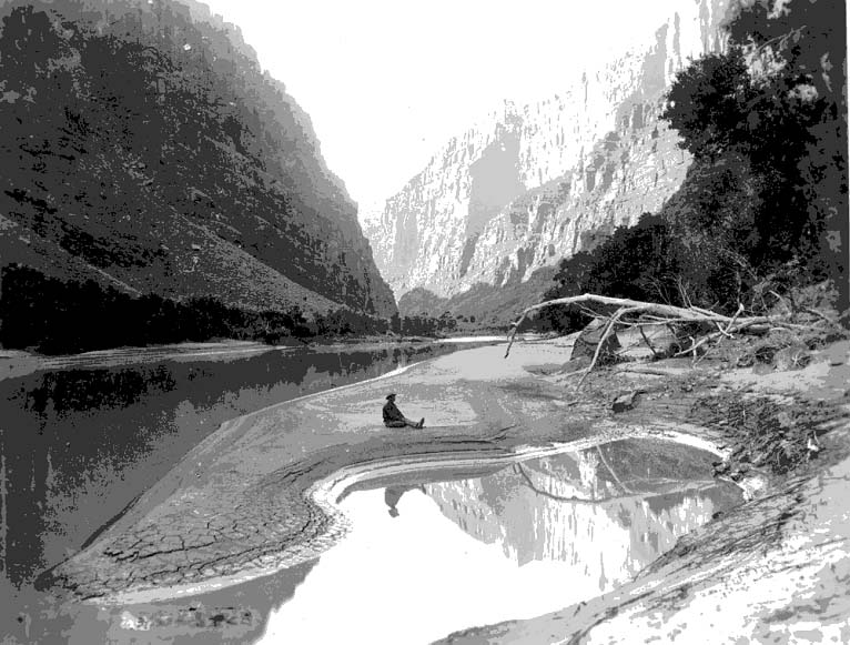
Major John Wesley Powell, a Civil War veteran, led a team of nine men in four small wooden boats on an exploration of the Colorado River and Grand Canyon. There are no photos from his first trip but some like this one exist from his second expedition in 1871. Photo credit National Park Service -
International Boundary and Water Commission created
The International Boundary and Water Commission was created by the U.S. and Mexico and is responsible for applying the boundary and water treaties between the U.S. and Mexico and settling any differences that may arise as a result of their application. -
1922 Colorado River Compact signed
Entered into by the seven basin states, the 1922 Colorado River Compact defines the relationship between the Upper Basin states (Colorado, New Mexico, Utah and Wyoming) and the Lower Basin states (Arizona, California and Nevada). Recognizing the need each individual state would have to develop water at its own pace , the compact protects each state’s right to develop its allocation. Each basin was allocated the right to use 7.5 million acre-feet of river water annually.Photo credit Bureau of Reclamation -
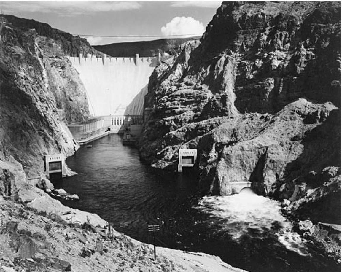
Boulder Canyon Project Act
Boulder Canyon Project Act ratified the 1922 Compact and authorized the construction of the Hoover Dam and Lower Basin irrigation facilities. California was apportioned 4.4 million acre-feet of water per year; Arizona 2.8 million acre-feet; Nevada 300,000 acre-feet. The dam was officially dedicated Sept. 30, 1935, and later renamed Hoover Dam in 1947 after President Herbert Hoover. Photo credit Ansel Adams, Our Documents -
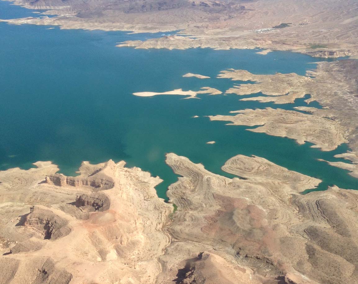
Lake Mead
Lake Mead, a man-made reservoir 25 miles southeast of Las Vegas, was created by the completion of Hoover Dam in 1935. It is the largest reservoir in the U.S. -
Mexican Treaty
Treaty for the Utilization of Waters of the Colorado and Tijuana Rivers and of the Rio Grande (commonly called the “Mexican Treaty”) committed 1.5 million acre-feet of Colorado River water per year to Mexico. Photo credit International Boundary and Water Commission -
Upper Colorado River Basin Compact
The Upper Colorado River Basin Compact created the Upper Colorado River Commission and outlined its roles and responsibilities. This compact also apportioned the Upper Basin allocation among Colorado (51.75%), New Mexico (11.25%), Utah (23%) and Wyoming (14%). The portion of Arizona that lies within the Upper Colorado River Basin was apportioned 50,000 acre-feet annually. -
Colorado River Storage Project Act
Colorado River Storage Project Act authorized the construction of Glen Canyon, Flaming Gorge, Navajo and Curcanti dams. The Act also authorized the construction of several other projects throughout the Upper Colorado River Basin, including the Central Utah Project and Emery County Project. -
Arizona v. California Supreme Court decision
The Arizona v. California Supreme Court case settled a dispute filed in 1952 over claims to Colorado River waters in the river’s Lower Basin. The court specified the amount of water to which each Lower Basin state was entitled. These amounts were confirmed in a 1964 decree. -
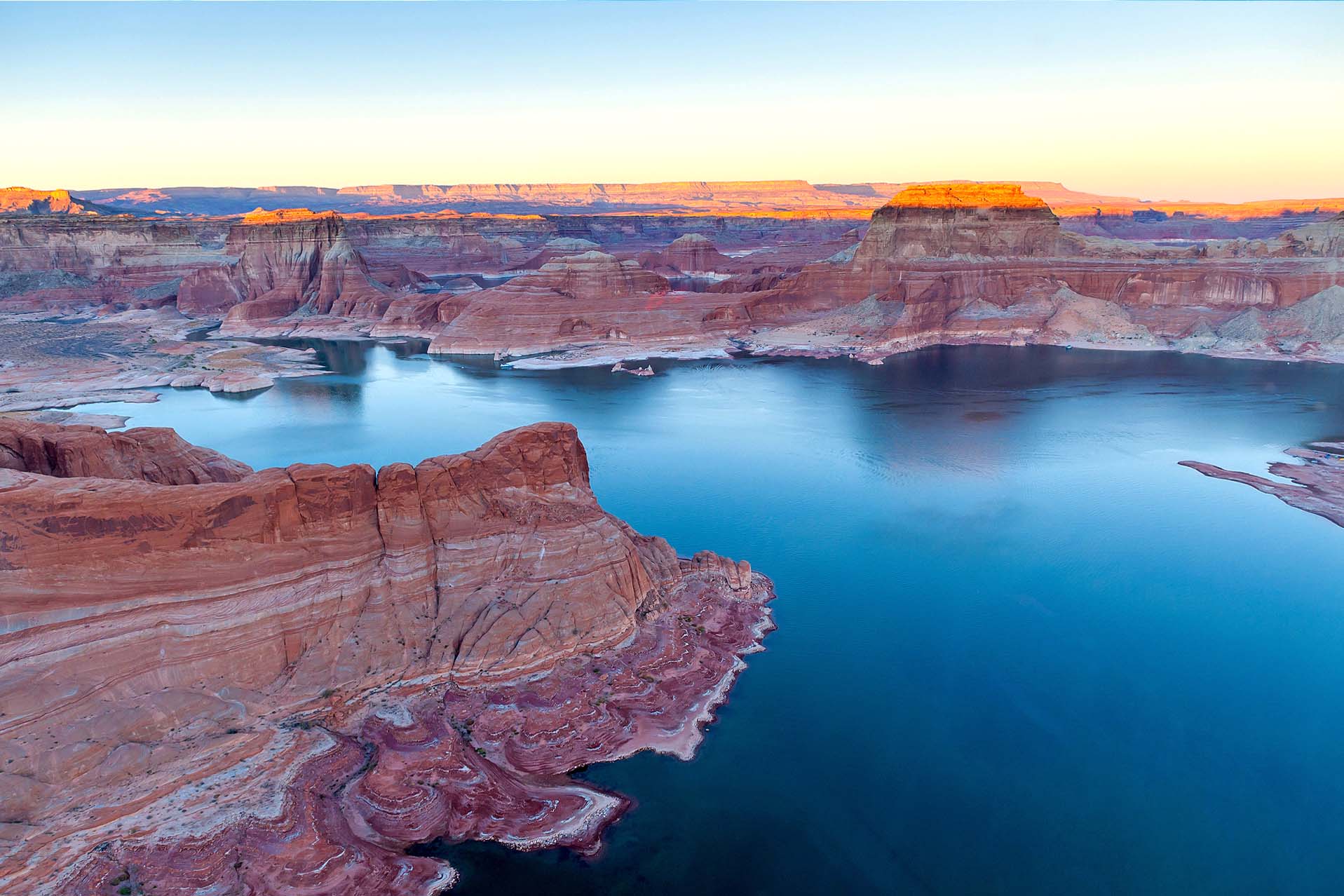
Lake Powell
When Glen Canyon Dam was completed on Sept. 13, 1963, Lake Powell began to fill. It took 16 years to fill to the 3,700 feet elevation level on June 22, 1980. It was built to store water and help the Upper Basin states meet their compact obligations while protecting the Upper Basin’s right to use its compact allocation. This reservoir water is also used for recreation and power generation.Colorado River Basin Project Act
The Colorado River Basin Project Act authorized the Secretary of the Interior to construct a variety of dams, power plants, reservoirs and related works relative to the Central Arizona Project.Interim Guidelines
The 2007 Interim Guidelines are currently in place and address the operations of Lake Powell and Lake Mead and allocate Lower Basin reductions in use during periods of drought. The guidelines expire in 2026.
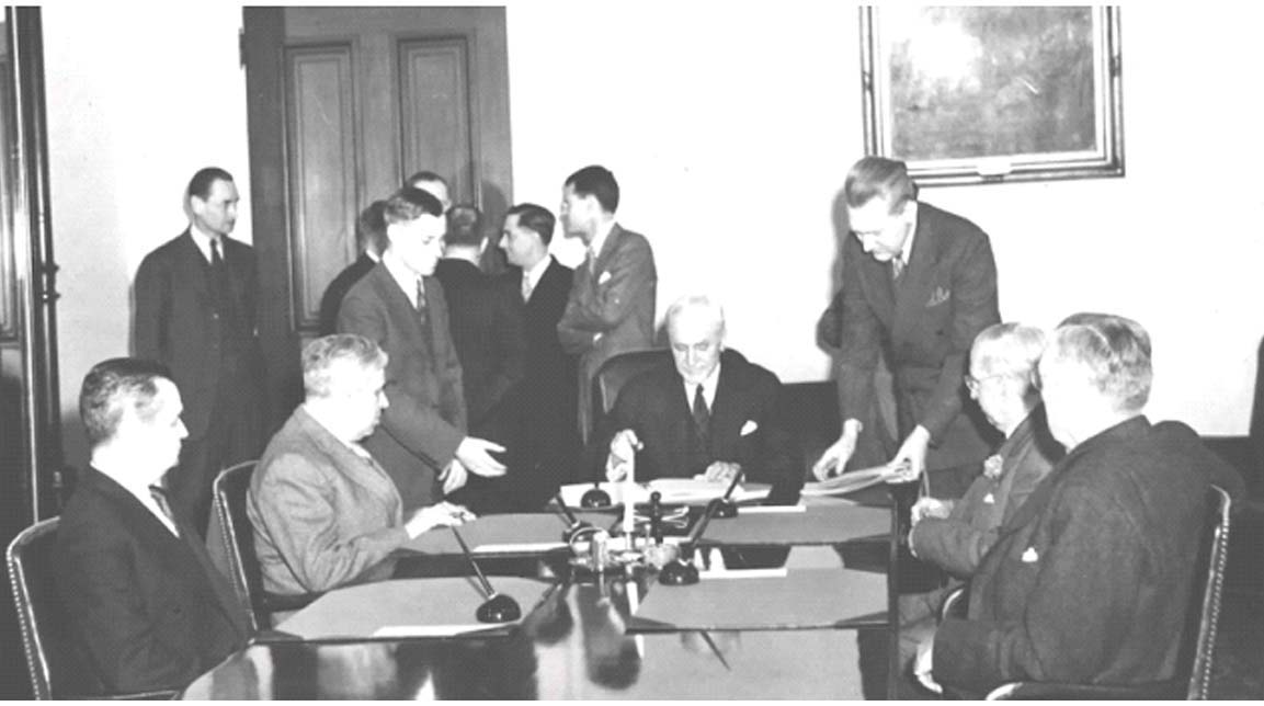
Drought Contingency Plan Signing
Water officials from the Colorado River Basin states joined representatives from the Department of the Interior and Bureau of Reclamation May 20, 2019, to sign drought contingency plans for the Upper and Lower Colorado River basins. These plans are designed to reduce risks from ongoing drought and protect the Colorado River. The Upper and Lower Colorado River basin states have developed contingency plans both independently and collaboratively. The product of these discussions is five documents that comprise the Drought Contingency Plan for the Colorado River. Photo credit Bureau of ReclamationThey include: