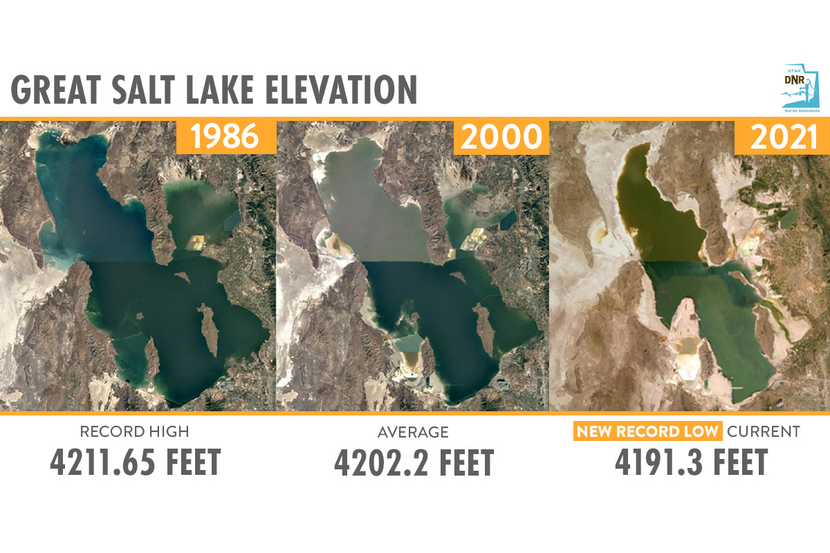
According to the USGS, the southern portion of the Great Salt Lake is at a new historic low, with average daily water levels dropping about an inch below the previous record set in 1963, according to U.S. Geological Survey information collected at the SaltAir gauge location.
“Based on current trends and historical data, the USGS anticipates water levels may decline an additional foot over the next several months,” said USGS Utah Water Science Center data chief Ryan Rowland. “This information is critical in helping resource managers make informed decisions on Great Salt Lake resources. You can’t manage what you don’t measure.”
Wind events can cause temporary changes in lake levels. Therefore, the USGS emphasizes that average daily values provide the most representative measurement. The USGS maintains a record of Great Salt Lake elevations dating back to 1847.
“While the Great Salt Lake has been gradually declining for some time, current drought conditions have accelerated its fall to this new historic low,” said Utah Department of Natural Resources executive director Brian Steed. “We must find ways to balance Utah’s growth with maintaining a healthy lake. Ecological, environmental and economical balance can be found by working together as elected leaders, agencies, industry, stakeholders and citizens working together.”
Streamflow levels across the state are also being impacted by extreme drought conditions. Currently, 63% (77/122) of streamgages with at least 20 years of record are reporting below-normal flows.
Current extreme drought conditions, water levels, weather and flood forecasts are available via the USGS National Water Dashboard on your computer, smartphone or other mobile device. This tool provides critical information to decision-makers, emergency managers and the public during flood and drought events, informing decisions that can help protect lives and property.
Contacts
USGS
Jennifer LaVista | 303-202-4764 | jlavista@usgs.gov
Division of Water Resources
Kim Wells | 801-803-0336 | kimwells@utah.gov